
Yunggulba (Floodtide)
2015
Giclée military map and synthetic polymer paint on canvas
2 x diptychs -
150 x 350 cm each panel, 300 x 350cm as a diptych
Courtesy of the Artist and Milani Gallery, Brisbane.
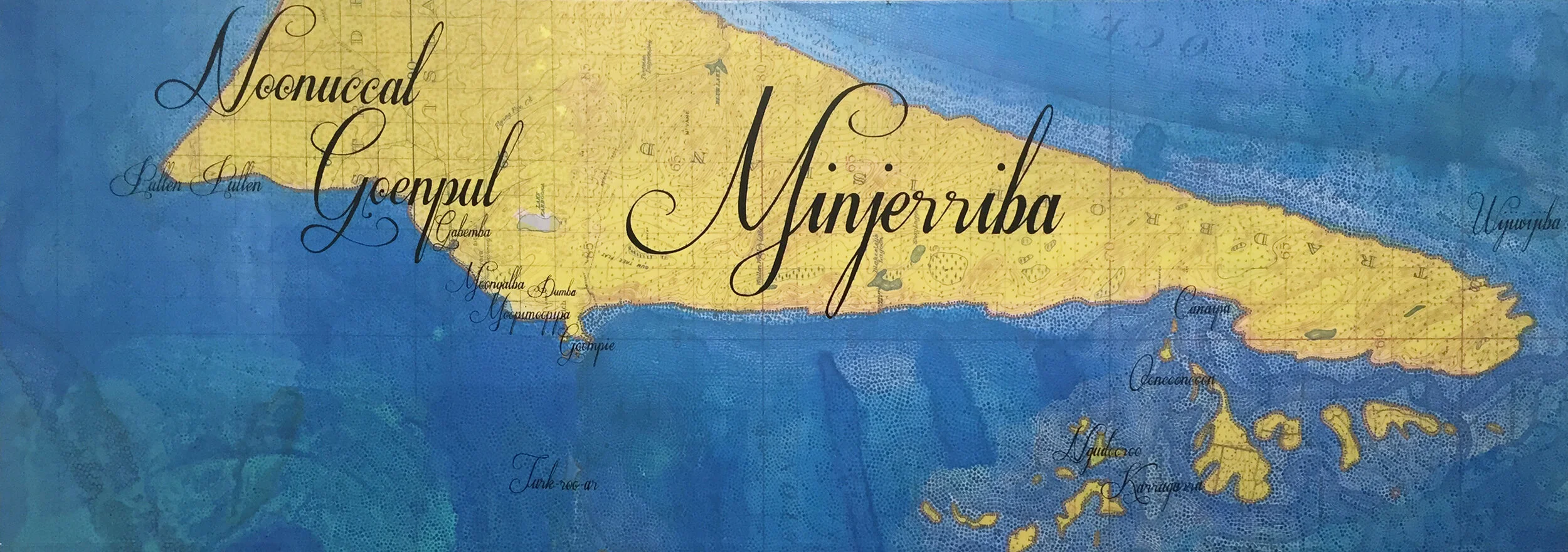
Yunggulba (Floodtide)
The Yunggulba paintings are an ongoing series of Megan Cope’s After the Flood work, which explore toponymy, geomorphology, and the latent consequences of rising sea levels throughout Quandamooka Country in South East Queensland.
Yunggulba meaning floodtide in Jandai language raises questions about climate change and vulnerability of residents along the coastline of Australia. Cope combines military topographical maps (circa 1930-45) with basic cartographic symbology to reveal multilayered landscapes, multiple histories and the legacy of colonialism on a traumatised landscape.
These works seek to challenge constructs of time, our sense of place and the fabric of our society that was formulated with the arrival of European settlers and convicts. Military maps echoing the myth of terra nullius and depicting the land devoid from Aboriginal occupation are now appropriated with significant names & places to Aboriginal groups.
New watermarks redefine coastal areas according to geophysical maps illustrating the possible effects of a sea level rise of approximately 5-7 metres; such cartography can be seen as central to future sustainability and highlights the fragile sense of time, place and identity in the land of fire & flood.
Toponomy and place names are an important aspect of culture and identity as they provide a location where history, events, landscapes and people are remembered, celebrated and most importantly, continued. Place names are almost always indicative of the dominant culture and current economic beneficiaries within a geopolitical landscape.
EXHIBITION HISTORY
Defying Empire: 3rd National Indigenous Art Triennial, National Gallery of Australia, Canberra 2017


Install view, Defying Empire: 3rd National Indigenous Art Triennial, National Gallery of Australia, Canberra 2017